
In short
Forest land of 2,254 m² owned by Gemini株式会社 in the Kamishiro area of Hakuba Village. Development concept under study.
- LocationKamishiro, Hakuba Village, Kitaazumi District, Nagano (shown at district level)
- Land area2,254 m² (registered area, one parcel)
- Building coverage / floor-area ratio30% / 50%
- Current statusDevelopment concept under study
Land facts
- Owner
- Gemini株式会社 (acquired July 2025)
- Location
- Kamishiro, Hakuba Village, Kitaazumi District, Nagano (shown at district level)
- Land area
- 2,254 m² (registered area, one parcel)
- Land category
- Forest (山林)
- City planning
- Within a city planning area (non-delineated); no zoning district designated
- Building coverage / floor-area ratio
- 30% / 50%
- Road access
- Faces public roads on two sides, northeast and southwest (each 6 m wide, frontage approx. 23 m)
- Utilities
- Mains water and electricity; wastewater by individual septic tank
- Subdivision
- Possible (minimum lot 350 m² under Hakuba Village development guidelines)
- Rights
- Ownership
- Nearest stations
- JR Oito Line Iimori Station approx. 1.6 km; Hakuba Station approx. 3.2 km
- Current status
- Development concept under study
Source: property page on the Gemini株式会社 company site (gemini-jp.com), checked 22 October 2026. Company page (canonical) ↗
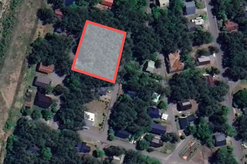
Photos and aerial views of the land


Photos: from the listing agency's property page (aerial images are map imagery with the plot marked). Provided by the owner.
Access (approximate road distance / drive)
- Happo-One (gondola): 3.8 km, approx. 8 min
- Hakuba Goryu: 4.9 km, approx. 10 min
- Hakuba 47: 5.3 km, approx. 11 min
- Hakuba Iwatake (gondola): 6.8 km, approx. 14 min
- From Nagano Station (Shinkansen): approx. 1 hour
Distances are approximate road distances; times are typical and longer in snow.
Next steps (to be confirmed): survey of boundaries, building confirmation, Hakuba Village landscape standards, forest felling notification, septic tank design.
This page introduces a development concept for land owned by Gemini. It is not an advertisement for the sale or lease of land or buildings. All content and images show the concept stage and may change.